make preferable
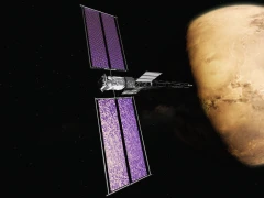
Japan’s Aerospace Exploration Agency (JAXA) is preparing for the final stage of deploying the national navigation system Quasi-Zenith Satellite System (QZSS), known as the “Japanese GPS.” On 1 February 2026, the seventh and final satellite of the “Michibiki” series (“showing the way”) will be placed into orbit. This will allow Japan to completely eliminate dependence on foreign positioning systems and provide centimeter-level accuracy of navigation in the Asia-Pacific region. JAXA confirmed this information, matching reports from the Commercial Times and Japanese media.
What QZSS is and why Japan invested in it
QZSS is a regional satellite system launched in 2010 to improve GPS accuracy in areas with poor signal reception: urban canyons, mountains, islands. The network consists of seven satellites in geostationary (GEO) and quasi-zenith orbits, providing visibility over Japan up to 99.9 percent of the time.
Unlike the American GPS (accuracy of 3–5 meters for civilian users), QZSS provides accuracy of 10–30 centimeters thanks to differential corrections and additional L6 signals. The system also transmits emergency alerts about earthquakes, tsunamis, and volcanic activity, which is critical for seismically active Japan.
Investments have exceeded 200 billion yen (about 1.3 billion dollars), including the H3 rocket, Japan’s analogue of the Falcon 9.
Launch timeline: from the first to the final
The first satellite, “Michibiki-1,” reached orbit in 2010, followed by three others in 2017. Full operation began in 2018 with four satellites. In 2025, JAXA accelerated the deployment schedule:
2 February 2025: “Michibiki-6” (H3-22S, successful launch).
7 December 2025: the sixth satellite (the second-to-last).
1 February 2026: the seventh and final satellite.
After February 2026, the constellation will be complete: seven satellites will ensure stable operation without reliance on external systems. By the 2030s, Japan plans to expand it to eleven satellites for global coverage.
Advantages of QZSS: centimeter-level accuracy and safety
QZSS works together with GPS, Galileo, and BeiDou, but its key strength is geometry: satellites near the zenith reduce errors caused by buildings and terrain. Accuracy for smartphones (Android and iOS with Qualcomm Snapdragon chips) reaches 6 centimeters horizontally and 10 centimeters vertically. This is a breakthrough for autonomous transport, agriculture, and search-and-rescue operations.
In Japan, QZSS is already integrated into smartphones (Sony, Sharp) and vehicles (Toyota, Honda). With accuracy thirty times better than GPS, it improves not only navigation but also real-time disaster response.
In brief
On 1 February 2026, JAXA will launch the seventh and final “Michibiki” satellite, completing QZSS, the “Japanese GPS,” with accuracy of 10–30 centimeters (compared to 3–5 meters for GPS). The network will provide Japan with independent navigation and disaster-alert capability. The second-to-last launch took place on 7 December 2025. This is a step toward a global system in the 2030s, positioning Japan as a leader in Asia.