make preferable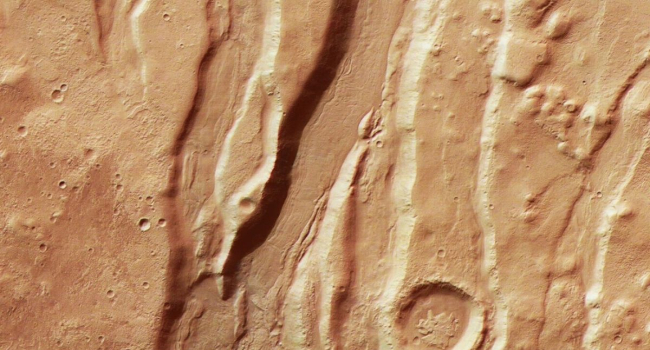
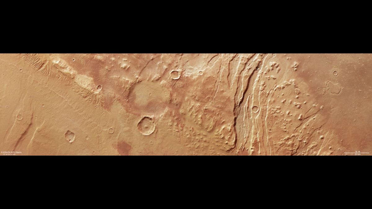
The European Space Agency’s (ESA) Mars Express spacecraft, which has been orbiting Mars for over 20 years, continues to unveil the secrets of the Red Planet. A newly released high-resolution image captures the western part of the Acheron Fossae region — an area with a unique landscape of fractures, ridges, and valleys. Formed billions of years ago, this region tells the story of Mars’ turbulent geological past. Here’s what makes Acheron Fossae special and what the new image reveals.
A Unique Landscape
Acheron Fossae is rich in dramatic geological formations, named after the Latin term fossae (fractures or channels). Here, Mars’ surface is sliced by deep cracks, creating alternating elevated ridges (horsts) and sunken valleys (grabens). These structures resemble long scars stretching for many kilometers.
- Origin of the fractures: According to ESA, the Acheron Fossae fractures formed about 3.7 billion years ago, during the peak of Mars’ geological activity. Rising molten material from beneath the crust stretched and split the surface, producing cracks tens of kilometers long.
- Rock glaciers: Over time, the region’s landscape was reshaped by massive rock glaciers — mixtures of stone, sand, and ice. Their slow movement carved rounded hills (knobs) and flat-topped plateaus (mesas), visible on the right side of the Mars Express image.
The photo also shows the contrast between the low-lying plains on the right and the high plateaus on the left. A wider view would reveal that the highlands extend all the way to Olympus Mons — the tallest volcano in the Solar System, standing 22 km high and located 1,200 km west of Acheron Fossae.
Traces of Cosmic Impacts
In addition to geological processes, Acheron Fossae’s terrain has been shaped by numerous impact craters scattered across its surface. Varying in erosion levels, these craters differ in age — from ancient to relatively recent. Like Earth, Mars is constantly bombarded by cosmic objects, but the lack of a dense atmosphere preserves its craters for billions of years.
The craters in the image demonstrate how Mars continues to evolve under external forces, complementing its internal geological history.
The Importance of the Image
The new Acheron Fossae image highlights the region’s value as evidence of Mars’ early history:
- Geological record: The fractures and rock glaciers point to an era when Mars was geologically active, possibly with volcanic and tectonic activity.
- Connection to Olympus Mons: The region’s proximity to the Solar System’s largest volcano makes it key for studying Mars’ global geological processes.
- Long-term observations: Mars Express, operational since 2003, continues to deliver high-resolution data, helping scientists create detailed maps and models of the Martian surface.
ESA has confirmed that Mars Express will continue its mission at least until the end of 2026, and possibly longer, allowing more data to be gathered on Acheron Fossae and other regions.
In Brief
The Mars Express image of Acheron Fossae’s western section reveals a complex geological history preserved in fractures, ridges, valleys, and craters. Formed 3.7 billion years ago, the region bears traces of tectonic activity, rock glaciers, and cosmic impacts. The new data not only deepen our understanding of Mars but also highlight its dynamic past. The mission’s continuation beyond 2026 promises further discoveries that will bring us closer to unlocking the secrets of the Martian landscape.