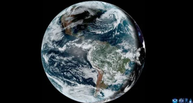
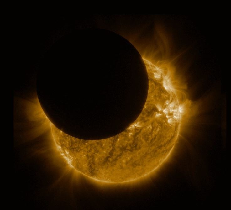
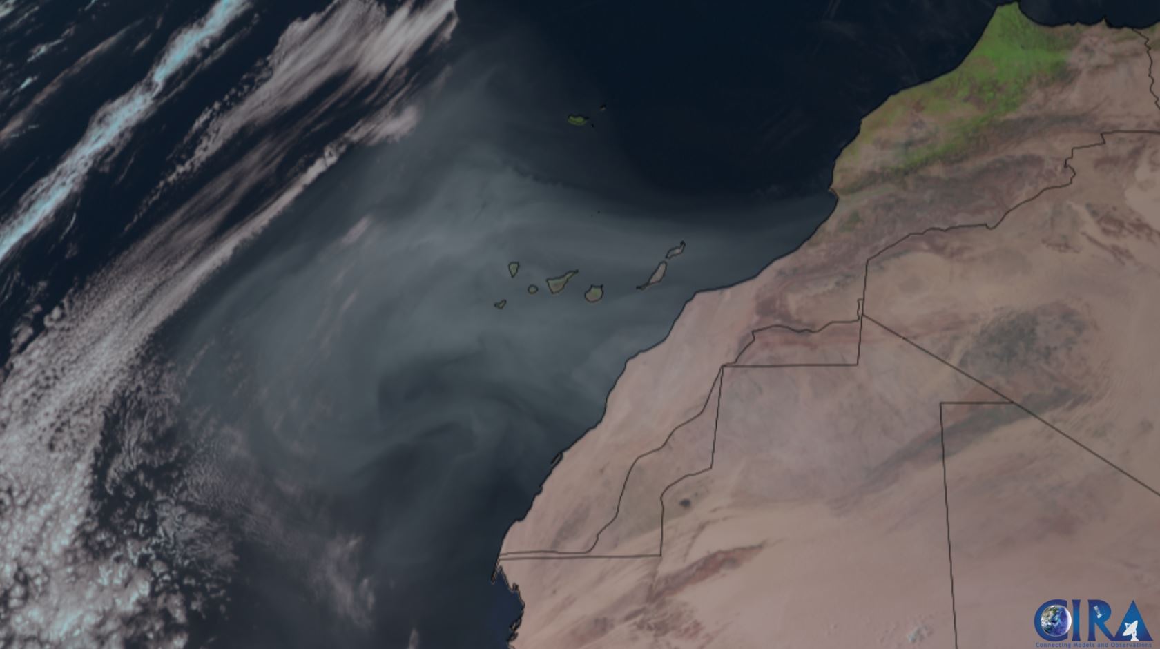
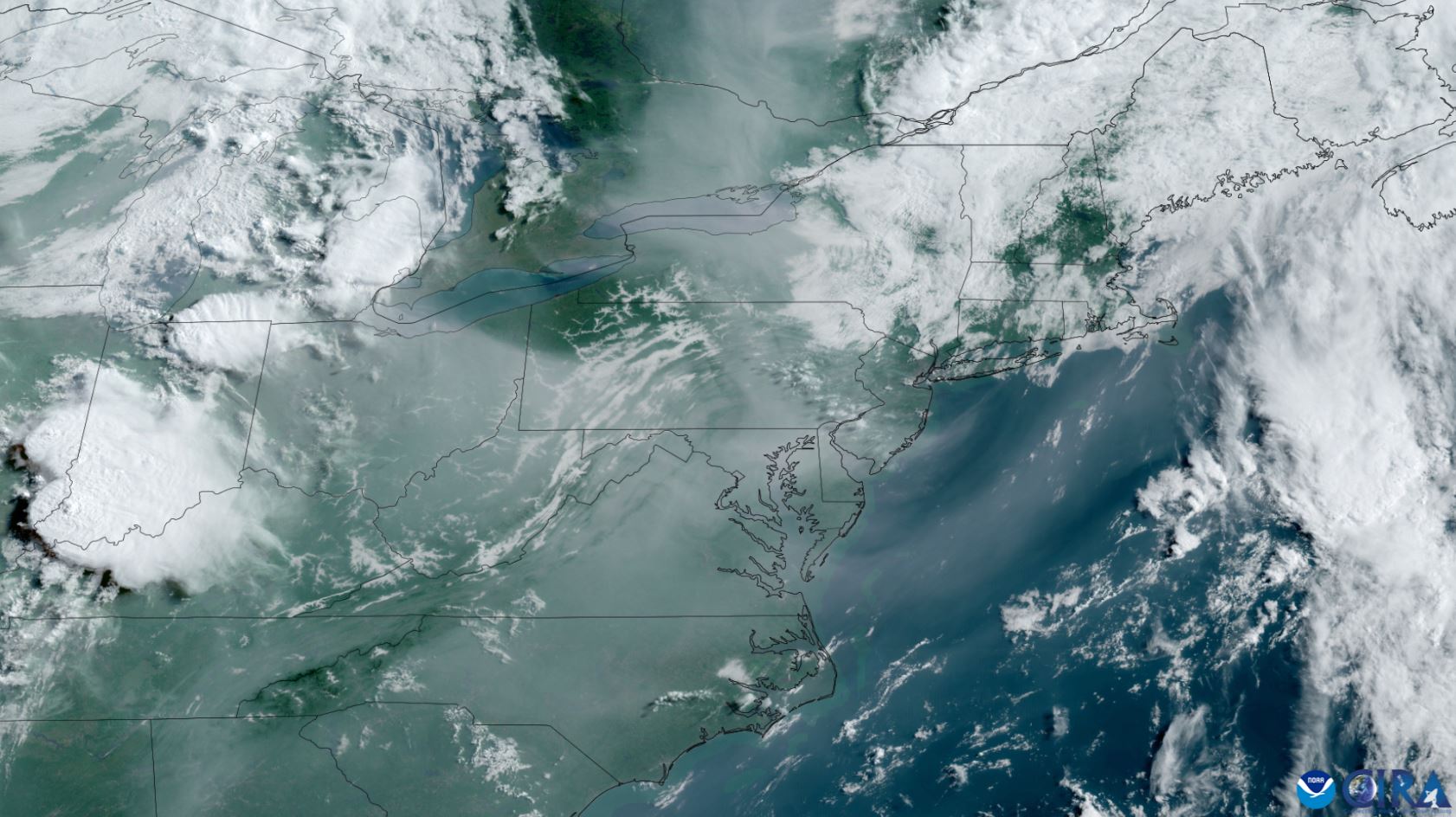
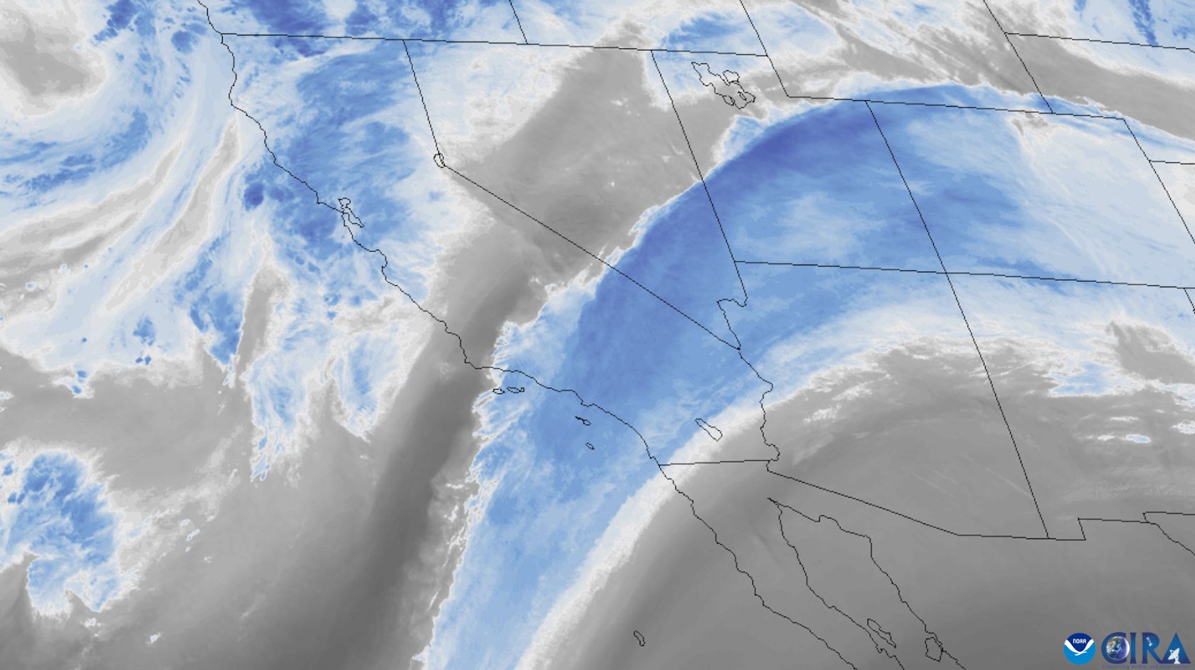
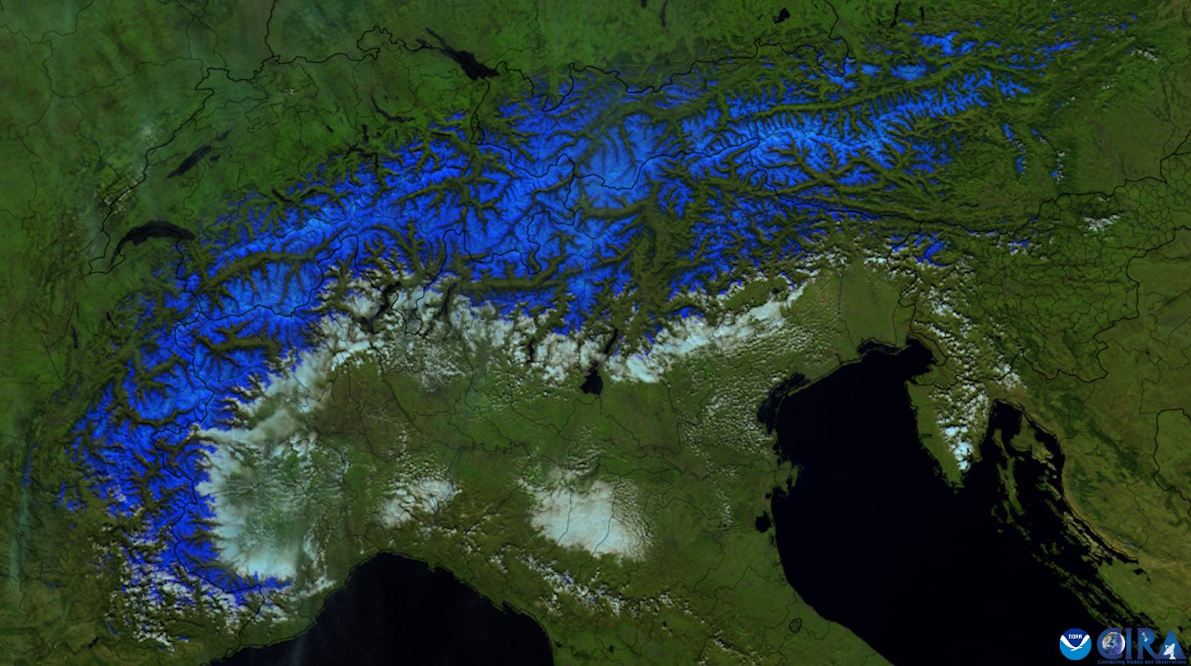
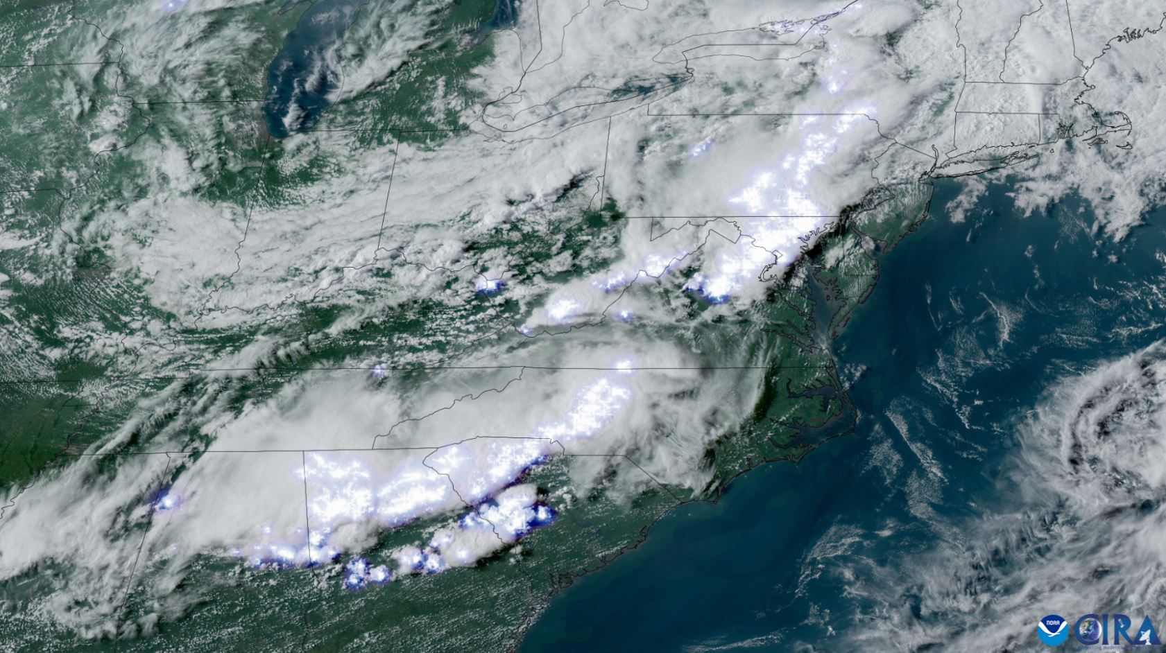
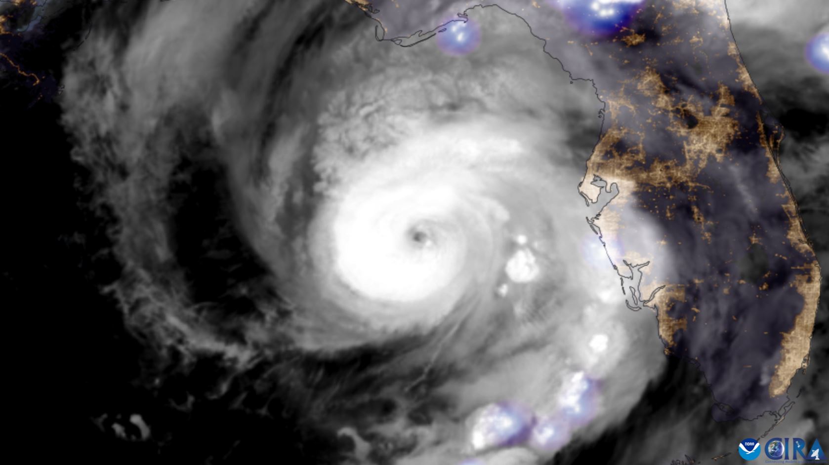
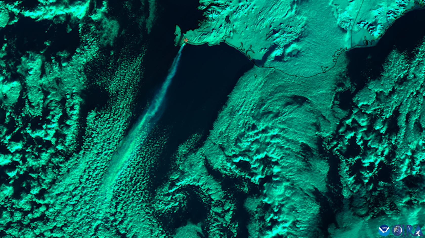
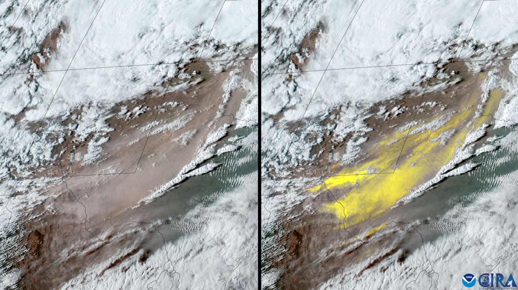
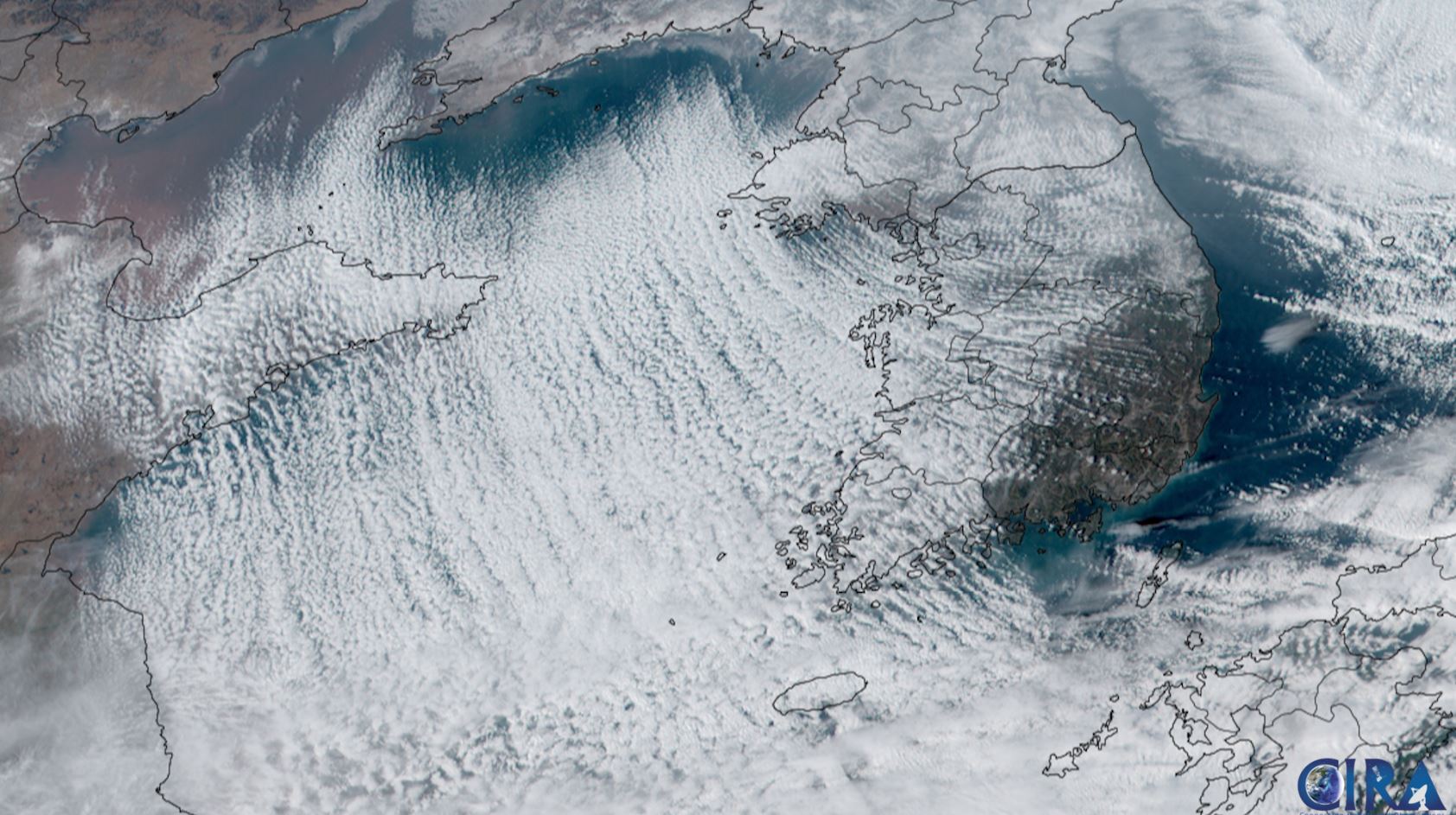
11 incredible satellite photos published on Earth Day
Every year on April 22, the world celebrates Earth Day, which once again provides an opportunity to focus on current environmental problems and highlight the efforts that are being made to continue to protect it.
One way to protect planet Earth has been to monitor its changing climate and atmospheric conditions through the US National Oceanic and Atmospheric Administration's (NOAA) Geostationary Operational Environmental Satellites (GOES) and Polar Operational Environmental Satellites (POES).
The GOES satellite network has been in operation since 1975, although the current series, GOES-R, was launched in 2016. The last satellite in the series, GOES-U, is expected to launch in 2024 on a SpaceX Falcon Heavy rocket.
In addition to monitoring our changing planet, the GOES series of satellites can monitor air quality, detect lightning strikes that can lead to wildfires, detect meteors entering Earth's atmosphere, and even warn of dangerous space weather.
Today, NOAA owns and operates ten satellites, including four geostationary, five polar orbiting, and one covering deep space. These satellites are scientists' eyes in the sky and allow us to constantly observe our planet and send back to Earth photos, measurements from various instruments that help improve weather forecasting.
These satellites also help with security and aviation route planning, wildfire and smoke detection, and data collection that provides more detail on the effects of climate change.
On the occasion of Earth Day, Space.com published remarkable photos, which we present below.

- Related News
- Wheel of Death: new method will help astronauts stay fit in low gravity
- Due to anomalies of Orion spacecraft, lunar exploration program may be delayed for years։ NASA
- TAO Observatory: World's highest telescope to study evolution of galaxies and exoplanets
- Powerful M9.5 solar flare causes radio blackout in Pacific Ocean
- What will happen to the Earth if the Moon disappears?
- Key to conquering the Red Planet: Why is NASA studying solar storms on Mars?
- Most read
month
week
day
- Digital Julfa Network is launching a pan-Armenian centre in the metaverse, on the Fastexverse virtual platform 848
- Sparkles: Boston Dynamics unveils a furry robot dog that can dance (video) 760
- Xiaomi unveils exclusive Redmi Note 13 Pro+ dedicated to Messi and Argentina national team 718
- Is there a ninth planet in the solar system? Scientists find new evidence 651
- Smartphone catches fire in child's hand in Russia 651
- How to understand how protected a smartphone is from water and dust? 616
- What will happen to the Earth if the Moon disappears? 614
- World's largest 3D printer was created in USL It prints 29 meter-long structures 612
- New iPad Pro to receive M4 chip and to be more powerful than Apple computers 588
- iPhone 16 may get colored matte glass back panel, 7 colors 587
- Archive